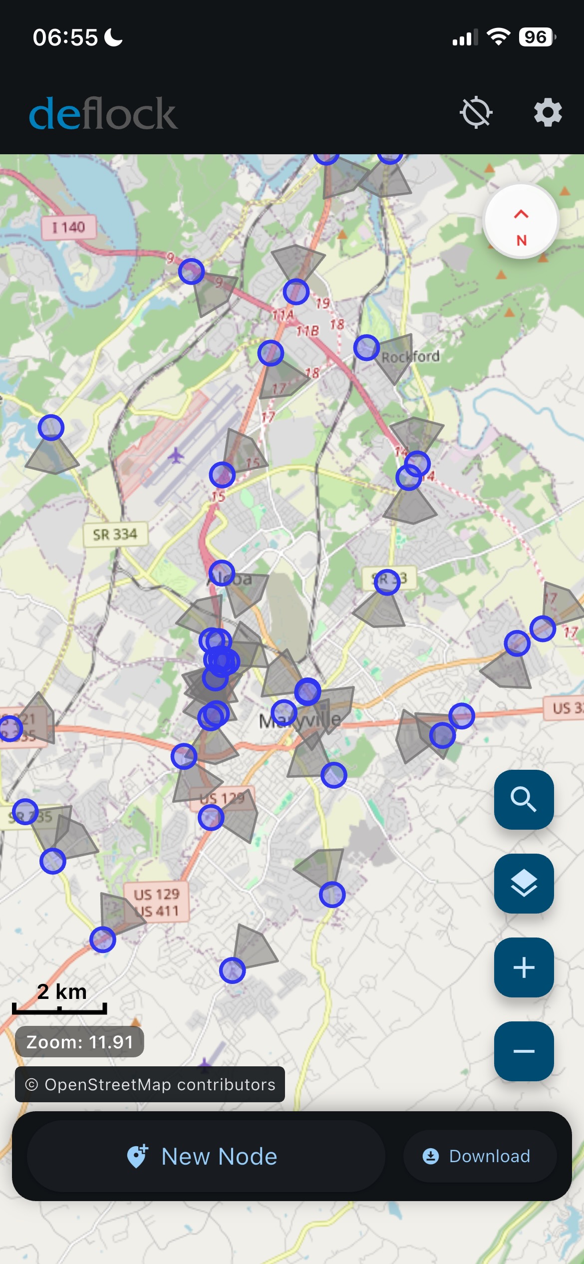
📍 Maryville Flock Camera Map (Blount County, TN)
Interactive map of known and observed Flock Safety surveillance camera locations
across Maryville, Tennessee, including neighborhood entrances, church roads,
school routes, and major intersections.
💡 Your email app will open automatically. Thank you for helping keep the
Maryville Flock camera map accurate.
Last updated: .
Locations are approximate and based on public observation and city records.
Maintained by MaryvillePrivacy.org
JavaScript is disabled. View the national ALPR map directly here:
DeFlock National Map
.
📱 DeFlock App – Report Cameras & Plan Camera-Avoiding Routes
The DeFlock web app makes it easy to discover and report automatic license-plate readers in your community and now offers route mapping to help you avoid known Flock and other surveillance cameras whenever possible.
-
Quickly add new ALPR camera sightings to the national map.
-
See plate-reader hotspots before you drive through Maryville or East Tennessee.
-
Generate suggested routes that try to minimize camera hits along the way.
DeFlock is an independent project. It gives residents practical tools to understand and reduce ALPR and Flock camera surveillance in their daily routes.
in and around Maryville, TN.
🗺️ East Tennessee ALPR Coordination Map
This map shows dozens of law-enforcement agencies in East Tennessee
that were invited to or coordinated through a Flock Safety “Deep Dive” training event
in Sevierville. The contact list came from a Tennessee Public Records Act (TPRA) request
and helps illustrate how Flock promotes a regional ALPR network, not just isolated cameras in one city.
The agencies on this map were part of a regional event where Flock Safety brought together
departments from across East Tennessee for a day of training and sales. Records describe how
the vendor walked officers through the Flock dashboard, data-sharing options, and tools that
flag which vehicles to stop based on travel history and patterns, not only traditional traffic violations.You can read the full background and see the documents here:
East Tennessee Regional ALPR Transparency Center
.
💡 Data source: internal email distribution list from a local agency obtained via TPRA.
Locations represent agency headquarters, not camera sites.
Map produced by MaryvillePrivacy.org
🎥 Learn More About Flock Cameras & ALPR Surveillance
These short videos explain how license plate surveillance works, how
Flock Safety cameras track vehicles and store data, and why communities like
Maryville, Tennessee are raising concerns.


❓ Facts & Answers About Flock Cameras, Maps, and Ghost Vehicles
This section collects some of the most common questions about Flock Safety cameras in
Maryville, Tennessee and the broader ALPR network, with links to full documentation
and analysis on MaryvillePrivacy.org.
What is the Flock “Safe List” / ghost vehicle list in Maryville?
Maryville Flock whitelist & ghost vehicles
.
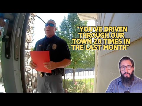
How is Flock training police to use travel history and “convoy” tools?
taught to use Multi-Geo and Convoy tools. These tools build travel histories and association patterns (who you drive near and when) and include a Tennessee scenario where officers are told they “got PC” largely from a vehicle’s travel pattern. That is the “guilt by travel” concern described on this site.The full training screenshots and explanation are here:
Flock’s Multi-Geo and Convoy tools in Tennessee
.
Is Maryville considering Flock AI drones or “drone as first responder” programs?
Maryville’s Flock drone program proposal
.
How can I find, report, or avoid Flock cameras in my area?
Maryville Flock Camera Map
on this page, which shows neighborhood entrances, church roads, and school routes where
Flock units have been observed.To report new camera locations or generate routes that try to avoid
known ALPR cameras, you can also use the independent
DeFlock app
, which crowdsources ALPR locations nationwide.
This page is part of a local citizen project in Maryville, Tennessee, documenting how
Flock Safety ALPR cameras, ghost vehicles, and potential drone programs affect
the everyday movement of law-abiding residents going to work, school, and church.